From Troy Montana, follow Highway 2 West for 9.5 miles to Yaak Highway 508. Follow Yaak Highway 508 for 18 miles north to Meadow Creek Road 524. Follow Road 524 1 mile to junction with Road 745. Take road 745 approximately 4 miles to Baldy Mountain Lookout Road 591. Follow 591 for approximately 2 miles to Road 5954. Take Road 5954 to the lookout.
Basic Info
Total Sites:
1
Aside from exploring Mount Baldy, hikers can find a network of trails in the surrounding Yaak Area. The Northwest Peaks Scenic Area, located in the northwest corner of the Yaak Area, offers a variety of hiking trails in beautiful settings.
Hunting is also possible nearby. Wild berries grow in the area, inviting berry pickers.
Below are the Free Visitor Guides for Bonners Ferry. More Visitor Guides are available in Idaho. Click here to view them all!
Visit Idaho Idaho
Visit Idaho
IdahoStart planning your Idaho adventure. Vacation is more than just scenery; it’s about making life long memories. Download or order the free Idaho Travel Guide here. Request this Free Visitor GuideRequested!You're all set! Complete the form below to receive your guides by mail.
We also have the following visitor guides in Idaho. Click on any additional guides you would like to receive.
Visit Idaho Idaho
Visit Idaho
IdahoStart planning your Idaho adventure. Vacation is more than just scenery; it’s about making life long memories. Download or order the free Idaho Travel Guide here. Request this Free Visitor GuideRequested!You're all set! Request a few more Visitor Guides, or complete the form below to receive your guides by mail.
Bear Lake Northern Utah
Bear Lake
Northern UtahBear Lake Valley lies on the border of Utah and Idaho, and is home to the "Caribbean of the Rockies", or Bear Lake. Visitors can enjoy a myriad of outdoor activities throughout the entire year. Request this Free Visitor GuideRequested!You're all set! Request a few more Visitor Guides, or complete the form below to receive your guides by mail.
Idaho High Country Southeast Idaho
Idaho High Country
Southeast IdahoBear Lake and Lava Hot Spring are found in Southeast Idaho, both exciting destinations for travelers from all over. Bear Lake is often called the "Caribbean of the Rockies" due to its vibrant blue color. Request this Free Visitor GuideRequested!You're all set! Request a few more Visitor Guides, or complete the form below to receive your guides by mail.
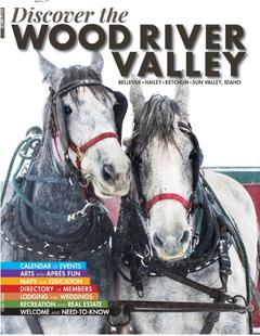
Discover Wood River Valley - Sun Valley Mountains
Discover Wood River Valley - Sun Valley
Mountains All the Best Adventures
For those with a High Altitude Attitude. Discover our Award Winning Visitor’s Guide Request this Free Visitor GuideRequested!You're all set! Request a few more Visitor Guides, or complete the form below to receive your guides by mail.
Box Elder County Northern Utah
Box Elder County
Northern UtahBox Elder County is known as a land of contrasts. Visit the the quaint and beautiful town of Brigham City, or get outside and experience any number of outdoor activities within scenic Box Elder County. Request this Free Visitor GuideRequested!You're all set! Request a few more Visitor Guides, or complete the form below to receive your guides by mail.
We also have visitor guides available in states highlighted in blue below. Click on any state to see what's available.
Alaska
Arizona
California
Canada
Colorado
Hawaii
Idaho
Michigan
Montana
Nevada
New Mexico
Ohio
Oregon
Texas
Utah
Washington
Wyoming
Switch to Mobile Browser Mode
We offer a compact version of Go-Idaho for mobile users, allowing you to access just the information you need on the road. Of course, you can still use the full version of Go-Idaho on your mobile device just as you can on your desktop.