


Contact Info
50 Highway 93 South
PO Box 600
Salmon, ID 83467
- Phone:
- 208-756-5100
Description
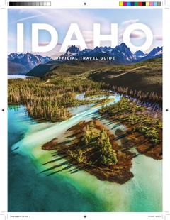
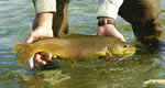
The Salmon-Challis National Forests are located in east-central Idaho with the impressive crests of the Bitterroot range forming the east boundary and the Idaho-Montana border. Elevations vary from 2,480 feet at the mouth of Horse Creek in the Salmon River Canyon, to 12,662 feet on top of Bora Peak. Visit the Salmon River Mountains in early spring as new bunchgrass blends with the old, casting a silver-green shadow across the hillls. Ride a raft down the bluegreen water of the foaming Middle Fork. Spot the mountain goat silhouetted against the sky; he has already been watching you. Fish for the mighty salmon as it migrates to the spawning beds in the head waters of the Salmon River. The really ambitious sportsman or sportswoman can fish for steelhead (ocean-going rainbow trout) in the Salmon River on Monday, then on Tuesday climb the peaks to hunt deer and elk as November snows mark winter's beginning.