


Contact Info
Salmon-Challis National Forest
HC 67 Box 650
Clayton, ID
HC 67 Box 650
Clayton, ID
- Phone :
- 208-838-3300
Basics
- Number of Sites:
- 7 sites
- Elevation:
- 8583 feet
Basic Directions
From Stanley: The Bayhorse Road takes off Highway 75, 19 miles downriver from the Yankee Fork Ranger District Office. It passes the old Bayhorse mining town and continues upward and onward to Big and Little Bayhorse Lakes. This dirt road is narrow and steep and while trailers are allowed, caution is advised.
From Challis: Approximately miles east on Highway 75, turn right onto Forest Road No.051 (at sign), and continue upward and onward 7 miles to Big and Little Bayhorse Lakes. This dirt road is narrow and steep and while trailers are allowed, caution is advised.
Description
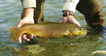
Beautiful high mountain lake is the setting for this out of the way campground. Plenty of fishing in lake and streams. Good hiking areas.
Amenities
Details
Season
July to SeptemberElevation
8583 feetBasic Info
- Total Sites:
- 7 sites


