Idaho Map

Request Free Visitor Guides

Black Canyon Trail - No. 820

Contact Info
Ochoco National Forest
7803 Beaver Creek Road
Paulina, OR 97751

Phone:
541-477-6900
Basics
Length:
11.7 miles
Difficulty:
Difficult
Time:
9 - 11 hours
Trailhead Elevation:
2850 feet
Elevation Range:
2850 feet to 6350 feet
Elevation Change:
3500 feet
Season:
Summer to Fall

Description

This scenic trail follows parallel to Owl Creek and Black Canyon Creek for the length of the wilderness, descending from near the summit of Wolf Mountain to the South Fork of the John Day River. The generally moderate trail gradient passes through a diverse mosaic of open ponderosa pine forest, dense mixed conifer forest, small meadows, shrubby streamsides, and open grassy slopes, ending in a narrow canyon between basalt cliffs. Trail No. 820 connects with all other developed trails in the wilderness, although some trail junctions are not marked. Undeveloped trailside campsites are most suitable for small groups. Some parties can make a one-way through trip in a single day by shuttling vehicles, but less ambitious day trips are generally more relaxing.

There are no bridges at stream crossings. Numerous wet fords of Black Canyon Creek are required, especially on the easternmost three miles of trail and at the trailhead crossing of the South Fork of the John Day River. River crossing in spring high water conditions can be extremely hazardous, and should not be attempted. Travel cautiously, and be alert for close encounters with rattlesnakes, black bear, mountain lions, and other wildlife – especially in dense vegetation. Trail is maintained every year to primitive standards.

Details

Length:
11.7 miles
Difficulty:
Difficult
Time:
9 - 11 hours
Trailhead Elevation:
2850
Elevation Range:
2850 feet to 6350
Elevation Change:
3500
Season:
Summer to Fall

Map + Directions

Basic Directions

Dusty Camp Trailhead is at the west end of Trail #820. From Paulina, travel 11 miles toward Rager Ranger Station to Forest Road #58. Follow FR #58 11 miles through Rager Ranger Station to FR #5840, then 6 miles on FR #5840 to Mud Spring Campground. Continue on FR #5840 an additional 3.7 miles to Dusty Camp Trailhead. Trailhead is signed. There is a small, unimproved parking area and one unimproved campsite located near the trailhead. Forest Road #5840 beyond Mud Spring Campground is unsuitable for two-wheel drive vehicles when wet, and is not recommended for low clearance vehicles or trailers at any time.

South Fork Trailhead is at the east end of Trail #820. Travel US Highway 26 to Dayville. Turn south on Grant Co. Road 42. Approximately 9 miles out of Dayville, Grant Co. Road 42 takes a right fork to a dead end. Take the left fork onto the South Fork Road for an additional 3 miles to the South Fork Trailhead. The South Fork Road continues to Forest Road #58 and Rager Ranger Station, and to Grant Co Highway 67 west of Izee. Trailhead is signed and marked by an information board/trail register. There is a small, developed parking area. Two small, unimproved campsites are located near the trailhead.

Trail #820 may also be accessed from Boeing Field Trailhead on Forest Road #5810 via Trail #820A.< The better standard road to Trail #820A is more suitable for use by low clearance vehicles.


Copyright © 1997 - 2024 The Go Travel Sites. All Rights Reserved and.

Email Page Link

Complete the form below to email this page to a friend or family member's email. You can send yourself an email as well. Your email and your recipient's email will NOT be shared with anyone. See our full Privacy Policy for details.
:
:
:


:
Copy Yourself on the Email Yes No
:
:

1

Select one or more Free Visitor Guides below

2

Complete the form to receive your guides by mail
Bear Lake Bear Lake Bear Lake
Northern UtahBear Lake Valley lies on the border of Utah and Idaho, and is home to the "Caribbean of the Rockies", or Bear Lake. Visitors can enjoy a myriad of outdoor activities throughout the entire year.
Request this Free Visitor GuideRequested! You're all set! Request a few more Visitor Guides, or complete the form below to receive your guides by mail.
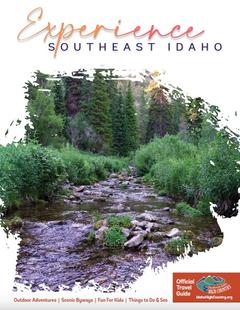
Idaho High Country Idaho High Country Idaho High Country
Southeast IdahoBear Lake and Lava Hot Spring are found in Southeast Idaho, both exciting destinations for travelers from all over. Bear Lake is often called the "Caribbean of the Rockies" due to its vibrant blue color.
Request this Free Visitor GuideRequested! You're all set! Request a few more Visitor Guides, or complete the form below to receive your guides by mail.
Box Elder County Box Elder County Box Elder County
Northern UtahBox Elder County is known as a land of contrasts. Visit the the quaint and beautiful town of Brigham City, or get outside and experience any number of outdoor activities within scenic Box Elder County.
Request this Free Visitor GuideRequested! You're all set! Request a few more Visitor Guides, or complete the form below to receive your guides by mail.
Visit Idaho Visit Idaho Visit Idaho
IdahoStart planning your Idaho adventure. Vacation is more than just scenery; it’s about making life long memories. Download or order the free Idaho Travel Guide here.
Request this Free Visitor GuideRequested! You're all set! Request a few more Visitor Guides, or complete the form below to receive your guides by mail.
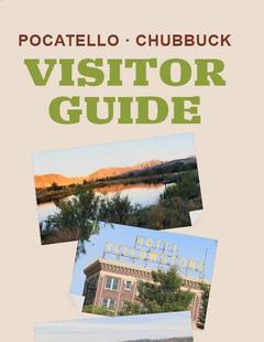
Visit Pocatello Visit Pocatello Visit Pocatello
Southeast IdahoChallenging rock-climbing, world-class mountain bike trails, disc golf courses and an active Greenway are some of the outdoor offerings right in Pocatello. Learn to squeegee at the world’s only Museum of Clean, stand in awe of saber tooth cats and giant bison at the Idaho Museum of Natural History, float the lazy river at the aquatic center, shop charming Old Town, or see Grizzlies and the animals of Yellowstone up-close at the Pocatello Zoo. Between Salt Lake City and Yellowstone National Park on I-15, it’s an ideal place to spend the night. Visit Pocatello for fantastic dining, attractions, events and lodging.
Request this Free Visitor GuideRequested! You're all set! Request a few more Visitor Guides, or complete the form below to receive your guides by mail.
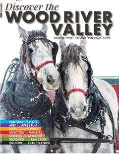
Discover Wood River Valley - Sun Valley Discover Wood River Valley - Sun Valley Discover Wood River Valley - Sun Valley
Mountains All the Best Adventures For those with a High Altitude Attitude. Discover our Award Winning Visitor’s Guide
Request this Free Visitor GuideRequested! You're all set! Request a few more Visitor Guides, or complete the form below to receive your guides by mail.