


Contact Info
716 West Custer
PO Box 507
Mackay, ID 83251
- Phone:
- 208-588-3400
Basics
- Length:
- 3 miles
- Difficulty:
- Easy,
Intermediate - Time:
- 1 to 1-1/2 hrs
- Trailhead Elevation:
- 7200 feet
- Season:
- July to October
Description
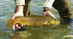
Hiker will wade Wildhorse Creek up a rocky area with scattered fir and aspen. The Devil’s Bedstead Peak is clearly visible from the head of the trail, and the first two miles will be an easy to moderate climb. The trail branches left to Boulder lake or straight up the mountain to Washington lake. Both lakes are above the timberline and offer fishing opportunities for those who are willing to traverse an unmarked area since the trail to the lakes is barely visible. This area is known for the mountain goats, eagles, pine squirrels, blue grouse and deer.
Details
Length:
Difficulty:
Intermediate
Time:
Trailhead Elevation:
Season:
Additional Details:
Trail begins: Access #1 begins at the mouth of Boulder Creek from Wildhorse Road #135. Access #2 begins at Little Kane Trail #63 extending from junction of Burnt Aspen-Kane Trail #55
Trail Ends: Boulder/Little Kane Summit
Conveniences available: There is parking available at Access #1. Also, Wildhorse Campground is within 1/2 mile of this trailhead for the overnighter.


