Idaho Map

Request Free Visitor Guides

Butte Creek

Contact Info
Umatilla National Forest
71 West Main
Pomeroy, WA 99347
Basics
Location:
located entirely within the Wenaha-Tucannon Wilderness in Southeast Washington

Description

From East Butte Trail out of Teepee Trailhead, the East Fork of Butte Creek and King Creek are accessible for fishing. The trail leading into the creek is steep and rocky. West Butte Trail out of Godman Trailhead leads to the intersection of the West and East Forks of Butte Creek. This trail gradually descends to Butte Creek. There is no trail downstream along the creek from this junction. Butte Creek enters an area known as "Box Canyon." This part of the stream is as challenging as the name implies. Travel is along sheer walls and in the stream channel and fishing this portion of the stream requires careful consideration. You would not want to be in this section during high water events.

Both Trails into the Creeks are well maintained for foot and horse traffic only since they are located within the Wenaha-Tucannon Wilderness. There are places to camp along the trails for close proximity to the creeks. It is possible to fish down the East Fork to the West Fork and make a loop. Rainbow trout and bull trout are the most commonly caught fish in these streams. You might get lucky in late summer and see a chinook salmon spawning. These fish sometimes venture into West Butte. Fishing this area can be both challenging and rewarding because of its remoteness and seclusion. The lower 2 miles of the main stem Butte Creek is in Oregon.

Fishing

Fish:
Bull Trout
Rainbow Trout

Details

Location:
located entirely within the Wenaha-Tucannon Wilderness in Southeast Washington
Additional Details:

Wilderness - No motorized equipment or mountain bikes.

Open to foot and horseback only.

Practice Leave-No-Trace camping ethics. Pack all garbage out.

Trail parking permit required at most trailheads.

Campsites must be located 75 feet away from live water.

Amenities

Map + Directions

Basic Directions

Godman Trailhead: From Dayton, WA, take 4th street south off Highway 12 for about four blocks. Turn east onto the Eckler Mountain Road (also the road to the city cemetery). Follow road about 16 miles to the National Forest Boundary. Follow Forest Road #46 for 12 miles to Godman Guard Station. Take West Butte Trail #3138 to the West Fork of Butte Creek.

Teepee Trailhead: From Dayton, WA, take 4th street south off Highway 12 for about four blocks. Turn east onto the Eckler Mountain Road (also the road to the city cemetery). Follow road about 16 miles to the National Forest Boundary. Follow Forest Road #46 for 12 miles to Godman Guard Station. Turn left on Road #4608. Follow road for 7 miles, taking all rights. Then take East Butte Trail #3112 to the East Fork of Butte Creek.


Copyright © 1997 - 2024 The Go Travel Sites. All Rights Reserved and.

Email Page Link

Complete the form below to email this page to a friend or family member's email. You can send yourself an email as well. Your email and your recipient's email will NOT be shared with anyone. See our full Privacy Policy for details.
:
:
:


:
Copy Yourself on the Email Yes No
:
:

1

Select one or more Free Visitor Guides below

2

Complete the form to receive your guides by mail
Bear Lake Bear Lake Bear Lake
Northern UtahBear Lake Valley lies on the border of Utah and Idaho, and is home to the "Caribbean of the Rockies", or Bear Lake. Visitors can enjoy a myriad of outdoor activities throughout the entire year.
Request this Free Visitor GuideRequested! You're all set! Request a few more Visitor Guides, or complete the form below to receive your guides by mail.
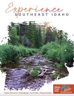
Idaho High Country Idaho High Country Idaho High Country
Southeast IdahoBear Lake and Lava Hot Spring are found in Southeast Idaho, both exciting destinations for travelers from all over. Bear Lake is often called the "Caribbean of the Rockies" due to its vibrant blue color.
Request this Free Visitor GuideRequested! You're all set! Request a few more Visitor Guides, or complete the form below to receive your guides by mail.
Box Elder County Box Elder County Box Elder County
Northern UtahBox Elder County is known as a land of contrasts. Visit the the quaint and beautiful town of Brigham City, or get outside and experience any number of outdoor activities within scenic Box Elder County.
Request this Free Visitor GuideRequested! You're all set! Request a few more Visitor Guides, or complete the form below to receive your guides by mail.
Visit Idaho Visit Idaho Visit Idaho
IdahoStart planning your Idaho adventure. Vacation is more than just scenery; it’s about making life long memories. Download or order the free Idaho Travel Guide here.
Request this Free Visitor GuideRequested! You're all set! Request a few more Visitor Guides, or complete the form below to receive your guides by mail.
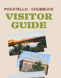
Visit Pocatello Visit Pocatello Visit Pocatello
Southeast IdahoChallenging rock-climbing, world-class mountain bike trails, disc golf courses and an active Greenway are some of the outdoor offerings right in Pocatello. Learn to squeegee at the world’s only Museum of Clean, stand in awe of saber tooth cats and giant bison at the Idaho Museum of Natural History, float the lazy river at the aquatic center, shop charming Old Town, or see Grizzlies and the animals of Yellowstone up-close at the Pocatello Zoo. Between Salt Lake City and Yellowstone National Park on I-15, it’s an ideal place to spend the night. Visit Pocatello for fantastic dining, attractions, events and lodging.
Request this Free Visitor GuideRequested! You're all set! Request a few more Visitor Guides, or complete the form below to receive your guides by mail.
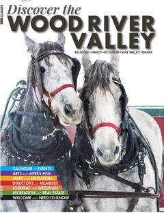
Discover Wood River Valley - Sun Valley Discover Wood River Valley - Sun Valley Discover Wood River Valley - Sun Valley
Mountains All the Best Adventures For those with a High Altitude Attitude. Discover our Award Winning Visitor’s Guide
Request this Free Visitor GuideRequested! You're all set! Request a few more Visitor Guides, or complete the form below to receive your guides by mail.